LiDAR SURVEY
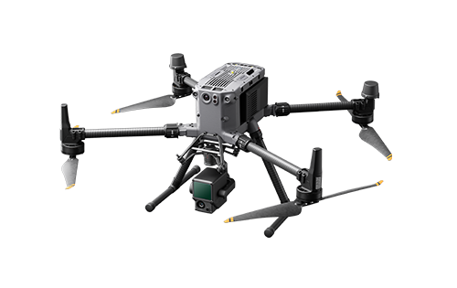
LiDAR (Light Detection and Ranging), also known as laser profiling, is an aerial mapping technology that uses laser sensors to capture terrain surfaces with extreme precision and rich detail.
We offer this cutting-edge service for planialtimetric surveys and mapping, particularly in challenging areas that are difficult to access, such as terrain with dense vegetation.
What is LiDAR and How Does it Work?
LiDAR works by emitting laser pulses that reflect off the ground, vegetation or buildings and return precise distance information to the sensor. This data is transformed into a highly detailed point cloud that accurately reproduces the terrain and its features.
This technology enables extremely detailed three-dimensional models to be created, which are useful in various sectors such as civil engineering, urban planning, architecture and construction.
LiDAR can "see" the ground even under trees and dense vegetation, making it ideal for many applications.
Main Advantages of LiDAR Surveying
1. Superior Accuracy: LiDAR is a technology renowned for the precision of its data. Even in challenging terrain, it can capture highly detailed information, resulting in extremely precise planimetric surveys. For topography projects, this level of accuracy is crucial in minimising measurement errors.
2. Speed and Efficiency: Compared to traditional surveying methods, LiDAR is much faster. In just a few hours, LiDAR-equipped drones can map large areas, capturing a massive volume of data that would take weeks to collect manually. This significantly reduces project execution time, enabling subsequent stages to progress more quickly.
3. Vegetation Penetration Capacity: Unlike conventional mapping methods, LiDAR can 'see' the ground through dense vegetation, capturing the true shape of the terrain. This is extremely useful for developers, subdivisions and urban development projects operating in rural or forested areas. It enables accurate and reliable topographic surveys, even in areas covered by dense vegetation.
4. Data Volume and Detail: In addition to speed and accuracy, LiDAR collects a vast amount of detailed 3D data. This provides a deep understanding of the terrain and enables the generation of digital surface and terrain models (DSM and DTM), which can be integrated with other planning and execution tools, such as BIM (Building Information Modelling).

Penetration into dense vegetation


Elevation point cloud, 3D textured mesh and terrain model.
LiDAR Applications
1. Planialtimetric Topography: LiDAR is most commonly used in civil engineering for planialtimetric topographic surveying, which is essential for the construction of roads, bridges, buildings, and other infrastructure projects. The precision of the obtained data allows elevations, depressions and terrain variations to be identified, facilitating planning and avoiding problems during execution.
2. 3D Modeling and BIM: LiDAR data can be easily integrated into 3D modelling and BIM software. This provides a virtual view of the construction site, enabling obstacles to be anticipated and interventions to be planned with much greater precision, thereby ensuring that construction proceeds as planned.
3. Infrastructure Projects: In urban and rural infrastructure projects, such as the construction of highways, railways and drainage systems, LiDAR is an essential tool for terrain analysis and construction planning. Its accuracy enables the creation of detailed technical reports, which are essential for project approval and execution.
4. Environmental Monitoring and Forest Mapping: Another relevant application of LiDAR is environmental monitoring and forest mapping, where capturing the soil beneath trees and vegetation is crucial. Developers and construction companies that need to analyse conservation areas or plan projects in rural areas can rely on LiDAR technology to obtain reliable data.
LuftPlan is a Specialist in Lidar Surveying / Laser Profiling
We specialise in topographic surveys and aerial mapping using LiDAR technology. We offer comprehensive solutions for construction companies, land developers, and engineering and architecture firms. Our highly qualified technical team is ready to meet the specific needs of your project.
In addition to our laser profiling expertise, we offer the following complementary services:
-
Aerial photogrammetry for mapping large areas;
-
Complete planialtimetric surveys, integrating LiDAR and other technologies;
-
We also provide 3D modelling and BIM integration to ensure your project is always up to date and digitally accessible.